Climate change is an urgent threat to the quality of life in urban areas.
Over half of the world’s population lives in cities, and that number is growing. From heat waves and floods to air quality alerts and disease emergence – cities are already suffering from the impacts of climate change. To protect urban residents and infrastructure, we are studying climate change risks to cities and developing science-based solutions to management challenges.
We can’t prepare for future climate challenges without understanding the environmental factors that influence them.
Guiding the management of heat risk in cities. Heat is the number one cause of death in US cities. By pinpointing where people are at risk, cities can prioritize resource allocation for cooling measures – things like planting trees, installing green roofs, or replacing dark pavement with light-colored materials that reflect heat.
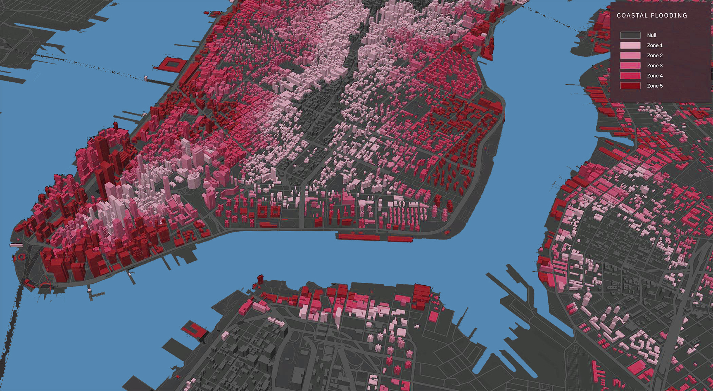
Investigating nature-based solutions to urban flooding. Many of the world’s most populous cities are situated on coasts. Flooding is a major risk due to sea level rise and intensifying storms brought on by climate change. By studying how built and natural features of the urban landscape interact with flood waters, we can guide city planning and evaluate flood management solutions.
Working at the intersection of climate change and environmental justice. Climate change is projected to impact low-income and minority communities most severely. This reality is a symptom of structural racism and legacies of environmental injustice in cities. We are working to identify equitable mitigation strategies.
Cary is working to achieve urban resilience and sustainability goals.
From New York City to Beijing, our urban ecologists share their expertise with city planners, decision makers, and managers. Most recently, they have teamed with collaborators across the US to assess 20 cities’ sustainability plans, with a focus on the role of green infrastructure and social equity.
HERCULES (High Ecological Resolution Classification for Urban Landscapes and Environmental Systems) is a powerful modeling tool to map and quantify the variations in building type, vegetation, and impervious surfaces that mark metropolitan spaces. HERCULES is useful in assessing land surface temperature patterns and helps integrate our ecological understanding of cities with the design of those cities.


