


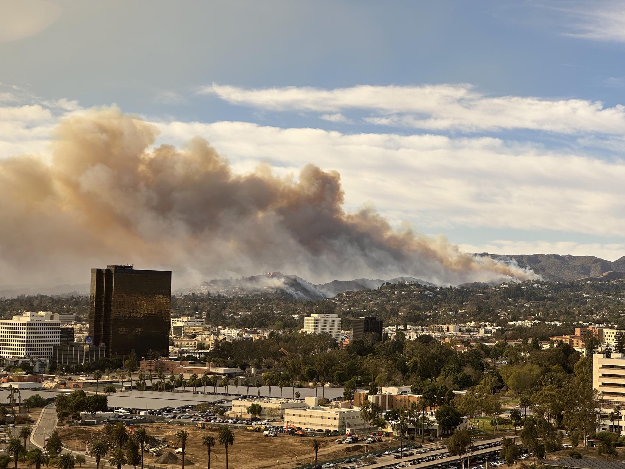
When several wildfires ignited in Los Angeles in early January of 2025, Miriam Marlier’s friends and neighbors came to her with questions about how to find reliable air quality information.
Marlier is a UCLA scientist and a member of the Western Fire and Forest Resilience Collaborative (WFFRC), a program of Cary Institute of Ecosystem Studies led by Cary forest ecologist Winslow Hansen. Guided by decision makers, the collaborative conducts research to inform solutions to the Western US fire crisis.
During the January fires, “people were urgently trying to find out whether the air was safe to breathe, where to find information about air quality, and whether the information was comprehensive enough for them to make decisions to protect themselves and their families,” explained WFFRC postdoctoral associate Claire Schollaert.
In response to these urgent questions, Schollaert, Marlier, and colleagues quickly launched a study to assess whether publicly available data sources captured an increase in air pollution during the fires, how air quality changed over space and time, and how the trends differed between data sets. The findings were published in Environmental Science and Technology Letters in July, and provide insights into how these tools can better support public health response during smoke events.
“This study is the first to my knowledge that quantifies how the LA Fires affected air quality at very fine spatial and temporal resolutions,” said Hansen. “It serves as a valuable baseline from an extraordinary event.” The study analyzed hourly data from nearly 750 low-cost and regulatory air pollution air pollution sensors throughout LA.
During large wildfires, government agencies generally recommend that residents check the Environmental Protection Agency’s air quality index, which is fed by data from regulatory monitors. The AirNow Fire and Smoke Map, another commonly recommended tool, relies on data from EPA monitors, low-cost PurpleAir sensors, and satellite data. But these tools utilize different data sources and often consider different time periods, potentially leaving residents confused.
“Smoke exposure is the main way that most people are impacted by fires,” said Schollaert. “Providing the public with understandable and accurate air quality information is crucial to reducing risk.”
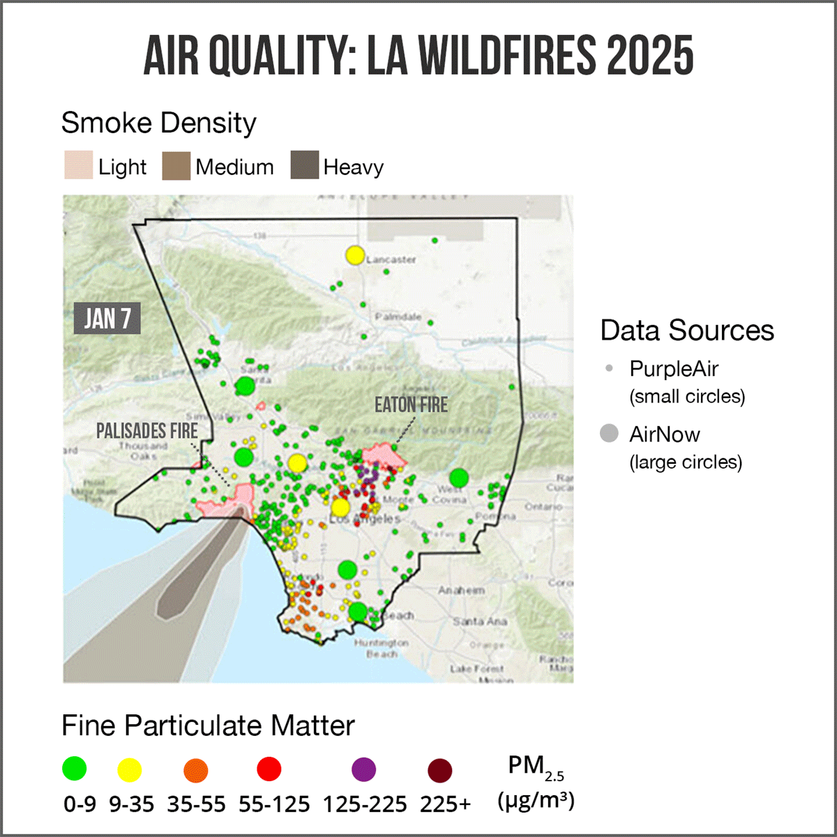
For the study, the researchers compared Los Angeles air quality data from EPA regulatory monitors, low-cost PurpleAir sensors, and satellites. “We wanted to understand the smoke plume dynamics from the perspective of multiple, often complementary, air quality data sources,” explains Marlier.
Findings confirmed that the fire events did degrade air quality in the city, particularly on January 8 and 9. But air quality varied markedly from hour to hour and day to day during the course of the fires, and “the Santa Ana winds, which played a role in spreading the fires, also did a decent job of pushing smoke from the Palisades fire offshore pretty quickly,” said Schollaert. Those same winds, however, spread smoke from the Eaton fire across the most populated parts of the county before pushing the plume out over the Pacific.
The team found that while regulatory monitors are essential, they often miss local variability due to limited spatial coverage. Integrating low-cost sensors and satellite data on public risk communication platforms can help fill critical gaps. This growing network of sensors can work with regulatory systems, to strengthen them, offering more responsive public health strategies and better community protection.
Satellite observations capture broader patterns of smoke movement through the atmosphere and could help to further fill in gaps between on-the-ground monitors, but the data are not as accessible to the public.
Smoke impacts were largely consistent across these different data sources, the team found, but differences in spatial distribution and averaging times could lead to discrepancies in air quality readings, which could be confusing to users.
Based on their findings, the authors call for more ground-based sensors to improve air pollution monitoring, and for the improved integration of satellite data into user-friendly air quality platforms. Preferably, these additional sensors and data sources would be integrated into the most commonly used air quality index resources, said Schollaert.
“People want one number that lets them know whether it’s safe to go running outside or take their kid to the playground,” said Schollaert. “It’s our job as researchers to try to figure out how to make that information as reliable as possible.”
“We live in an era of data saturation,” said Hansen. “Often these datasets tell us slightly different things at different resolutions of space and time. Now more than ever, effective actionable science is about harmonizing and synthesizing these diverse datasets to provide consistent, robust, and digestible insights to the public, managers, and policy makers.”
Responsiveness to real-world needs is baked into the WFFRC approach, and the new study provides one example of how this strategy can lead to meaningful impacts and important scientific insights.
Citation
Air Quality Impacts of the January 2025 Los Angeles Wildfires: Insights from Public Data Sources
Claire Schollaert, Rachel Connolly, Lara Cushing, Michael Jerrett, Tianjia Liu, and Miriam Marlier. Environmental Science & Technology Letters. DOI: 10.1021/acs.estlett.5c00486
This research was made possible, in part, by funding from the Gordon and Betty Moore Foundation under grant #11974. The paper is a contribution of the Western Fire and Forest Resilience Collaborative and the Climate and Wildfire Research Initiative at UCLA.
Western Fire and Forest Resilience Collaborative (WFFRC) is an interdisciplinary research program of Cary Institute of Ecosystem Studies focused on advancing fire ecology and forest resilience science across the western U.S. By connecting science with practice, WFFRC aims to advance fire and forest resilience strategies that are ecologically sound, science-informed, and adaptable to rapidly changing environmental conditions.
Cary Institute of Ecosystem Studies is an independent nonprofit center for environmental research. Since 1983, our scientists have been investigating the complex interactions that govern the natural world and the impacts of climate change on these systems. Our findings lead to more effective resource management, policy actions, and environmental literacy. Staff are global experts in the ecology of: forests, freshwater, disease, and cities.


